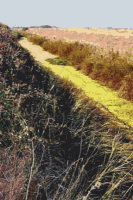
Canalised Hundred
River (Aldeburgh N. Haven)
All
human groups consciously change their environments to some extent. One might even argue
that this, in combination with language, is the crucial trait distinguishing people from other
animals. Probably the best measure of a culture’s
ecological stability is how its management of the
environment maintains its ability to reproduce itself. Furthermore, it is the instability of human
relations with the environment that explains both cultural and ecological transformations as part of
the historical process. A cultural history begins by assuming a dynamic and changing relationship
with the land. Environment may initially shape the range of choices available to a people at a given
moment, but then culture reshapes the land in responding to those choices. The reshaped
environment presents a new set of possibilities for cultural reproduction, thus setting up a new
cycle of mutual determination. Changes in the way people create and re-create their livelihood must
be analysed in terms of changes, not only in their social relations but in their ecological ones as
well. Human and non- human worlds are too entangled for us to comprehend them together
holistically. We can never know the entire heaven and an entire earth. We should try to locate a
nature which is within rather than external to history, for only by so doing can we find human
communities which are inside rather than outside nature. We may regret the passing of the hunter-
gatherer in the primeval Suffolk forest, or the recent removal of a dense network of ancient
hedgerows to make way for prairie grain-growing technology, but the choice is not about intrinsic
values of landscapes past and present. The choice of view is between two human ways of living,
two ways of belonging to an ecosystem, that requires establishing new ecological equilibria
between people and their land.
Relations between people and the land are not constant, but rather historical and
dialectical, and
those relations are seen as being within one system. The study of such relations is usually best
done at the local level, where they become most visible. However, the choice of a small area has
one crucial problem: how do we locate its boundaries? In anthropology this has simply involved the
area within which people conduct their subsistence activities, often described using ‘ethno
ecological’ techniques which analyse the way the inhabitants themselves conceive of all aspects
of
their territory. A further complication is that, as time passes, it is increasingly difficult to know
which ecosystem is reacting with which culture. This erasure of boundaries may itself be the most
important issue of all.
In Suffolk, the first physical evidence of local territorial divisions are the coaxial
networks of small
fields that appear to predate Roman roads, which slice through them like a modern by pass. The
first notional evidence are the descriptions of boundaries in Anglo Saxon charters that describe
perambulations through the landscape, giving directions from tree to tree, river to river and hilltop
to
hilltop. Until the late 16th century all territorial divisions of the land were presented in this way.
Cartography was a relatively late invention and presented these descriptions as zig- zag lines that
for the most part (eg parish boundaries) followed the edges of fields, which in Suffolk, may have
originated in the late Iron Age, but only became generally visible when the Tithe Maps were created
in the 1840s.
The Hundreds represent divisions of land based on groups of people with a common identity,
and
may well be based on patterns of tribal settlement of Anglo Saxon immigrants. It is thought that
these peoples did not have to carve out homesteads in virgin country but actually commandeered
earlier field systems. The boundaries of the hundreds were first mapped in the 18th century, when
they were aligned with the shared parish boundaries of villages at their edges. Originally they
probably followed less precise topographic features such as watersheds and more precisely, rivers
and streams that were part of collective folk memory. This is certainly true for the Blything
Hundred, but the topographic analysis of the other hundred boundaries remains to be investigated.
This is one aim of the present research, the other being to make a pictorial record of the differences
between the Hundreds in terms of past and present land management and its connections with
drainage patterns, the hilliness of the ground, the range of soils, and patterns of work and
settlement